
Elizabeth ZIP Code Directory Coverage
Elizabeth has four practical delivery ZIPs that should be verified one address at a time: 07201, 07202, 07206, and 07208. The USPS ZIP Lookup is the final delivery check. A city-and-state search returns the ZIPs associated with the city, while an address search returns the specific delivery result. USPS also warns that a returned ZIP does not verify that a person or company is at the address.
| ZIP | Areas Covered | Post Office | Notes |
|---|---|---|---|
| 07201 | Union Square and portions of central and southern Elizabeth | USPS Union Square, 946 Elizabeth Avenue | Official location evidence; delivery boundary is address-specific |
| 07202 | Central Elizabeth delivery area | USPS routing material labels Elizabeth 07202 | Use the exact-address return for the current footprint |
| 07206 | Elizabethport-area historical and current addresses | Official postal materials show Elizabeth 07206-2122 | Retail assignment and delivery footprint need a live address check |
| 07208 | North Elizabeth and main-station area | Elizabeth Station and North Elizabeth station | Official location evidence supports this delivery label |
| 07204, 07205, 07207 | Routing, legacy, or post-office-box references | USPS labeling material maps these to Elizabeth 07208 in the cited scheme | Do not call these ordinary city delivery ZIPs without a USPS result |
That distinction is why a ZIP code directory should not replace postal validation. A list can orient the search, but only the result for the complete street address identifies the delivery ZIP and recognized city label in use at the time of the search.
Elizabeth ZIP Code Union Square
For 07201, the research found USPS Union Square at 946 Elizabeth Avenue, Elizabeth 07201-9992. The research also associates the label with Union Square and portions of central and southern Elizabeth. Those statements are useful orientation, not a boundary line. An address on a nearby block can have a different postal assignment, and a city label can extend beyond the area a reader informally calls Union Square.
Enter the full street address before using a tax or election record. Save the returned ZIP, post-office name, recognized city spelling, and search date. If a city-and-state result offers several choices, it remains a broad city list. The address result is the one that can normalize mail for a defined location. Postal delivery says nothing about title, municipal jurisdiction, or who is connected to the property.
Elizabeth ZIP Code North Station
USPS location evidence identifies two 07208 stations: Elizabeth Station at 310 North Broad Street, 07208-9998, and North Elizabeth at 772 Newark Avenue, 07208-9991. The label is associated with North Elizabeth and the main Elizabeth station area. This is the clearest official station evidence in the research set, but it still does not draw a postal line around every nearby street.
For 07202, the available official routing material supports a central Elizabeth delivery label. For 07206, official school and postal materials show Elizabeth addresses using 07206-2122 and point toward Elizabethport-area use. Neither finding confirms a complete delivery boundary. A live USPS address result is required before describing an exact address as part of either service area.
Note: Keep 07204, 07205, and 07207 separate from the four practical delivery ZIPs unless the postal service returns one for the complete address.
Check Elizabeth ZIP Code Delivery
The official USPS tool has three useful forms. By Address accepts a full address and returns the delivery ZIP. By City and State returns the complete ZIP list tied to a city. Cities by ZIP returns the cities served by a supplied ZIP and reminds users to use a recognized city name for quicker delivery. The live tool returned HTTP 403 during the research crawl, so its captured interface should be rechecked in a browser before relying on any changed label or result.
| USPS form | Captured fields and use |
|---|---|
| By Address | Company optional; required Street Address; Apt/Suite/Other; City; State; ZIP; then Find. It can accept full street, city, and state or street plus ZIP. |
| By City and State | City, State, and Find. Use it to see the full city list, not to assign a single address. |
| Cities by ZIP | ZIP and Find. It returns cities served and the recognized-city delivery note. |
Use the full address for the initial result, then compare the returned postal details with the parcel's situs address. A ZIP code is a mail-routing label. It is not a person verification, a parcel identifier, or evidence that two addresses fall inside the same city limit.
Find Elizabeth ZIP Records
No official Elizabeth parcel or voter interface reviewed for this project provides a confirmed ZIP filter that can enumerate every address or registered voter in an area. The assessment search uses Location, Owner Name, Block, Lot, and Qualifier. NJGIN uses address, county, municipality, block, and lot. The voter status checker's ZIP behavior could not be verified because its live page was unavailable to the crawler. Use ZIP only to validate an address, then move to the source designed for the actual records question.
- Use USPS By Address to validate the full delivery address and save the returned ZIP and postal label.
- Use the NJGIN parcel resource or the county map route to locate the address by municipality, parcel, block, or lot.
- Check the Elizabeth assessor and the New Jersey county/district assessment search for the location, owner name, block, lot, or qualifier.
- For election geography, use the Union County polling workflow or submit a defined request to the election custodian, including the needed format and redactions.
Once a ZIP narrows the general area, the Elizabeth street directory supplies the address-keyed record trail. It is the better route for block, lot, deed, and tax-map research. The ZIP has done its limited task when the delivery address is normalized.
Elizabeth ZIP Code Tax Maps
Postal labels and parcel descriptions must remain separate. The Elizabeth tax-map index provides municipal block and lot sheet links. It is useful when an address must be tied to a physical parcel or a historic street reference. A tax map can help compare the situs address, streets, dimensions, and parcel identifiers, but it does not certify postal delivery or identify a current occupant.
The city's tax-map index is the appropriate official starting point for this Elizabeth ZIP code directory parcel cross-check.
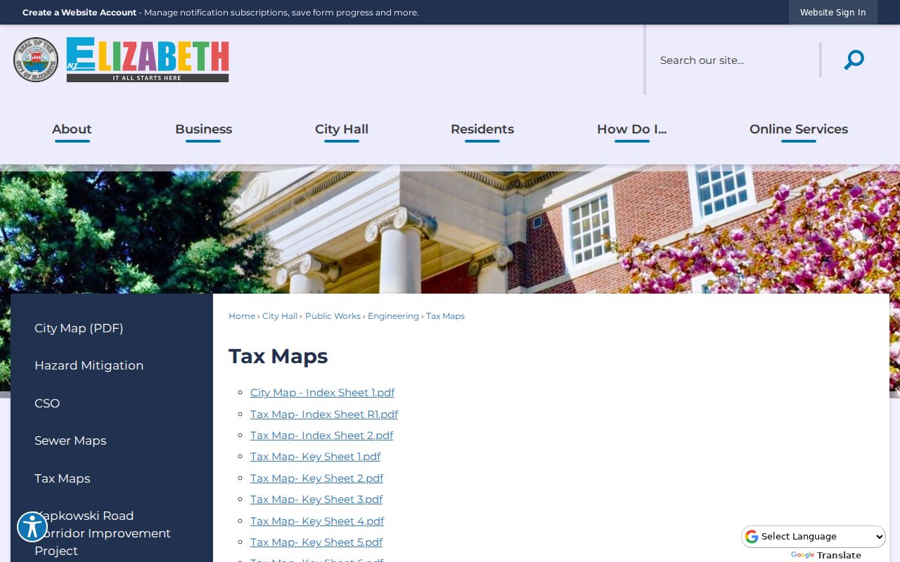
Use the map's block and lot with assessor or GIS data after USPS confirms the address's postal result.
The three address concepts can differ. The situs address identifies the parcel location. The tax mailing address tells the assessor where a notice is sent. The legal description identifies the titled parcel by block, lot, qualifier, and sometimes metes-and-bounds language. None is interchangeable with a postal ZIP.
Elizabeth ZIP Code Boundaries
Postal boundaries are delivery geography, not municipal or county lines. A ZIP can serve a station, a post-office box, an institutional address, or a route near a city edge. A courthouse mailing label can also create confusion because county offices and city geography are not the same thing. The Union County map, tax maps, and parcel records answer location questions; USPS answers delivery questions. Do not use one of those sources to overwrite the other.
- ZIP and ZIP+4
- A ZIP identifies a broad postal delivery area. ZIP+4 adds a narrower delivery segment for mail sorting.
- Post-office-box ZIP
- A ZIP associated with box service or routing material may not describe ordinary street delivery in the city.
- Unique ZIP
- A unique ZIP is assigned to one organization or high-volume destination. The reviewed Elizabeth sources did not establish one for the city.
- Carrier route
- A carrier route is a delivery sequence used by the postal service. It is not a municipal boundary or a public address list.
When the tax map, voter address, and postal result disagree, keep each source in its own role. Use the parcel record for land, the Board of Elections for election geography, and USPS for delivery. That split is especially important around a postal label that overlaps a nearby Union County area.
Elizabeth ZIP Directory Fallbacks
For an old address without a modern ZIP, start with the street, cross street, block and lot, tax-map sheet, or legal description. Elizabeth historical directories and the Library of Congress criss-cross material use streets and house numbers rather than modern postal codes. The Library of Congress identifies Elizabeth street-address material for 1954 and 1956 through 1959. Earlier directory work should use the street, landmark, and period spelling instead of adding a modern ZIP to an old entry.
No reviewed source established an unincorporated Elizabeth pocket or enclave within the city. Use the municipal boundary and the Union County map when a postal route approaches another municipality. Confusion is more likely to come from postal routing, county offices, or a post-office-box label than from a hidden city boundary. An Elizabeth postal city name can be useful for mail, while the tax map and legal description remain the more precise route for a parcel's municipal setting.
The research did not locate a confirmed standalone address-assignment or E911 custodian page for Elizabeth. The assessor, Engineering and Tax Maps, Planning or Zoning, and Union County GIS are the practical questions to pursue when a location needs correction. Request address-point history or readdressing records by street, block, and year. The post office, assessor, and address authority need not use the same boundaries.
Note: Record the USPS query date and response, then keep it beside the parcel identifiers rather than treating a postal label as a complete local-record search.